Kilimanjaro
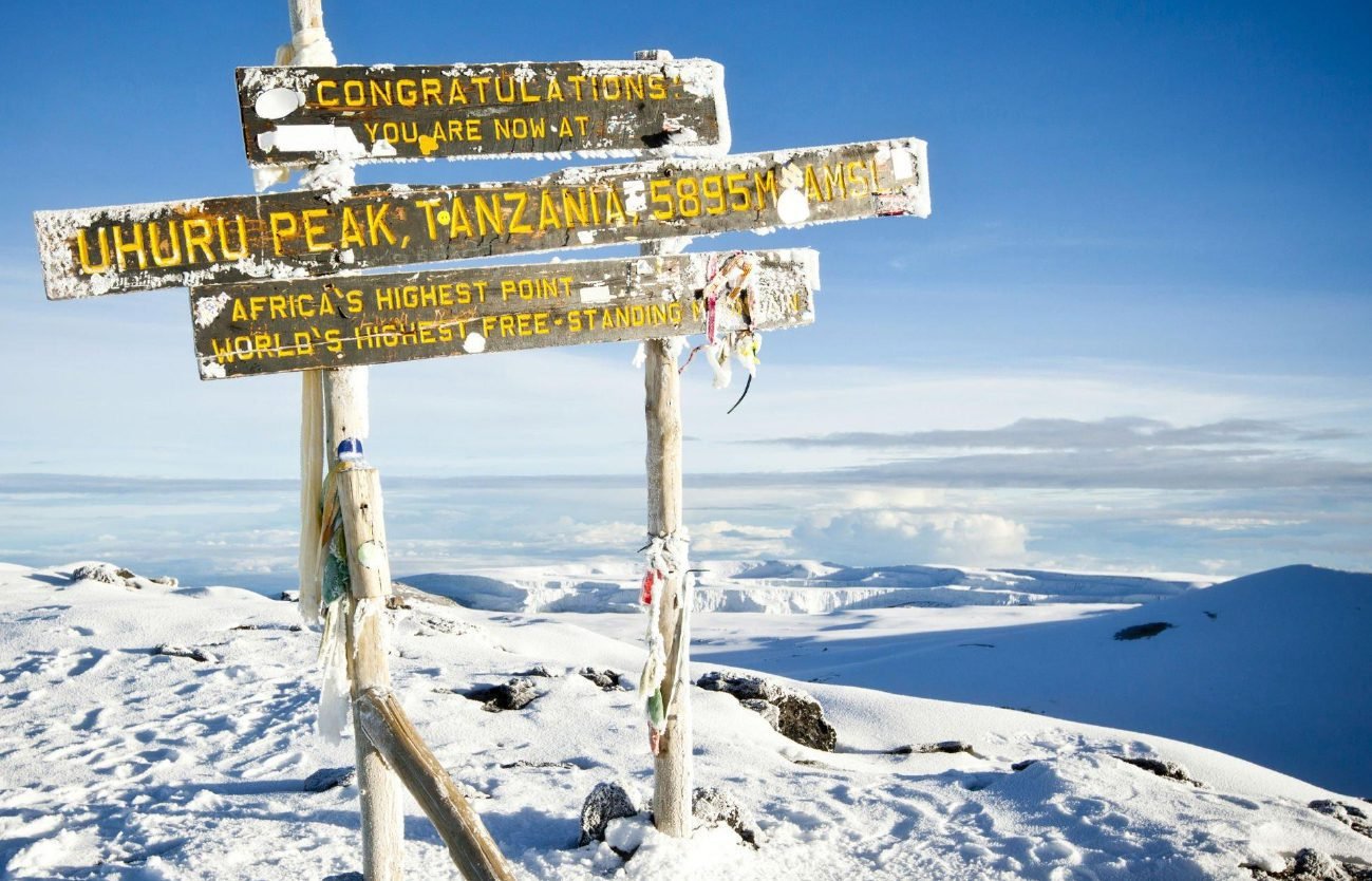
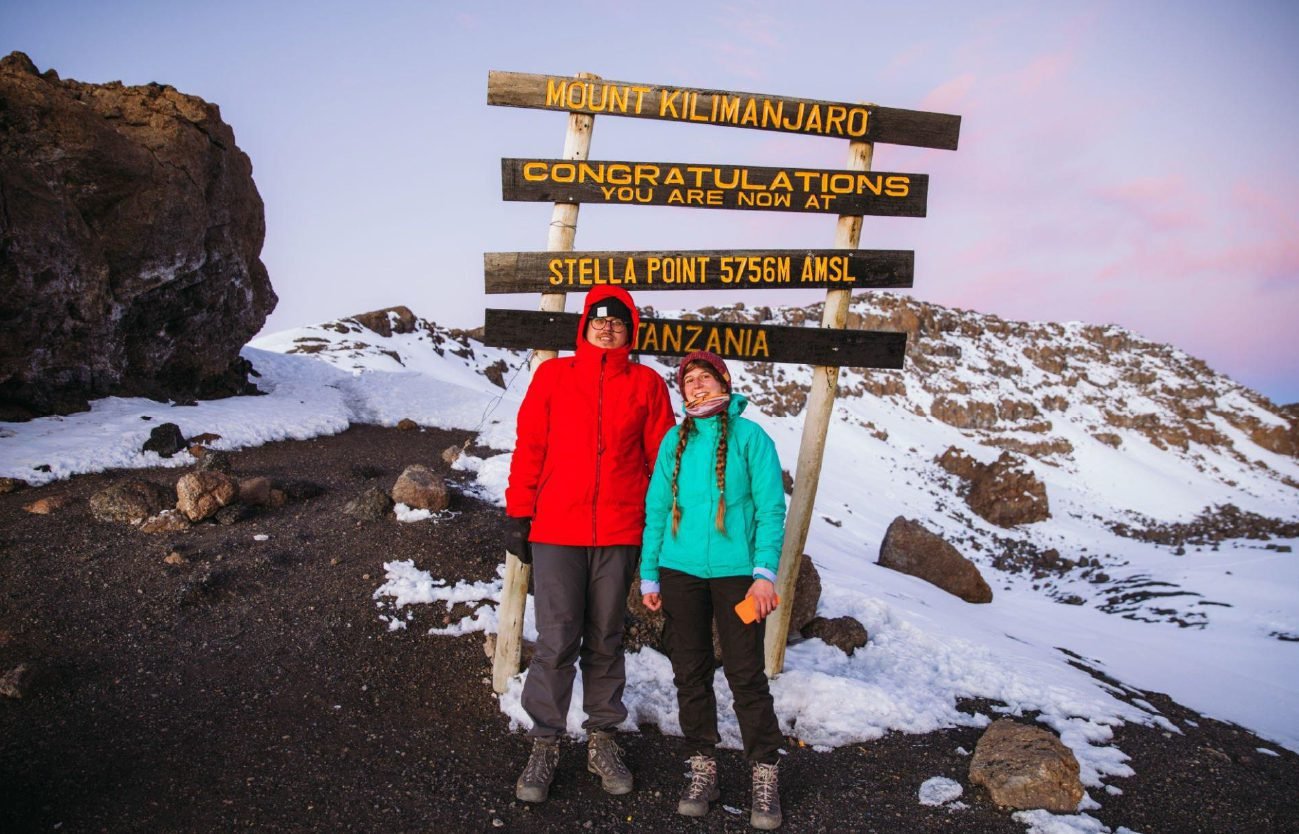
Climbing Kilimanjaro is the experience of a lifetime. It’s certainly not hard to see why this trek tops bucket lists around the world. The mighty Mount Kilimanjaro is the highest mountain in Africa at a staggering 5,895 metres (19,341”), and the world’s highest free-standing mountain. Though many of the mountain’s routes are not for the faint-hearted, with an experienced guide at your side, you certainly don’t need to be an experienced climber to reach its summit.
Mount Kilimanjaro
Mount Kilimanjaro is a dormant volcano located in the Kilimanjaro Region of Tanzania. It has three volcanic cones: Kibo, Mawenzi, and Shira. It is the highest mountain in Africa and the highest single free-standing mountain above sea level in the world: 5,895 metres (19,341 ft) above sea level and about 4,900 metres (16,100 ft) above its plateau base. It is the highest volcano in Africa and the Eastern Hemisphere. Kilimanjaro is the fourth most topographically prominent peak on Earth. It is part of Kilimanjaro National Park and is a major hiking and climbing destination. Because of its shrinking glaciers and ice fields, which are projected to disappear between 2025 and 2035, it has been the subject of many scientific studies.
Location Of Mount Kilimanjaro National Park
This national park is located in Tanzania south of the border with Kenya. It is also situated North East of Arusha National Park and a person in Arusha town is very capable of viewing the Mountain clearly from the comfort of their hotels or lodges as they sip a cup of tea. Kilimanjaro National Park covers an area of 1688 square kilometres and is located at coordinates of 2°50’–3°10’S latitude and 37°10’–37°40’E longitude. Mount Kilimanjaro the biggest attraction in this national park is strategically located and one can easily be accessed through different routes which favors the hikers to make their choice depending on the ease of hike. Kilimanjaro National Park can be accessed by road and by flight. One can decide to fly into Kilimanjaro International Airport which is one of the biggest national parks in Tanzania.
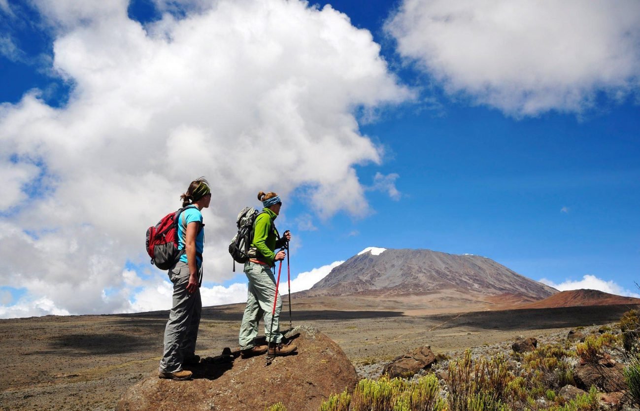
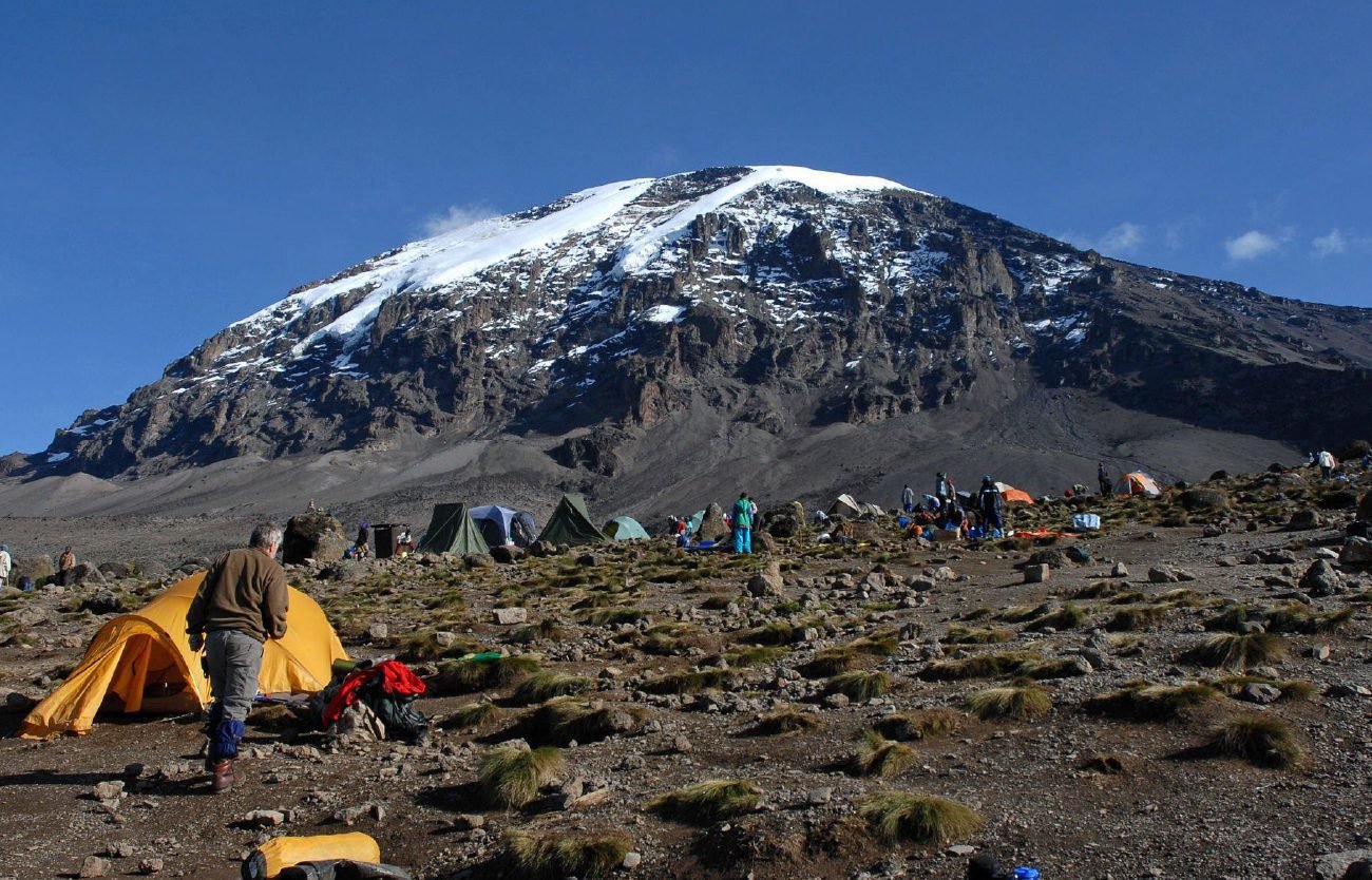
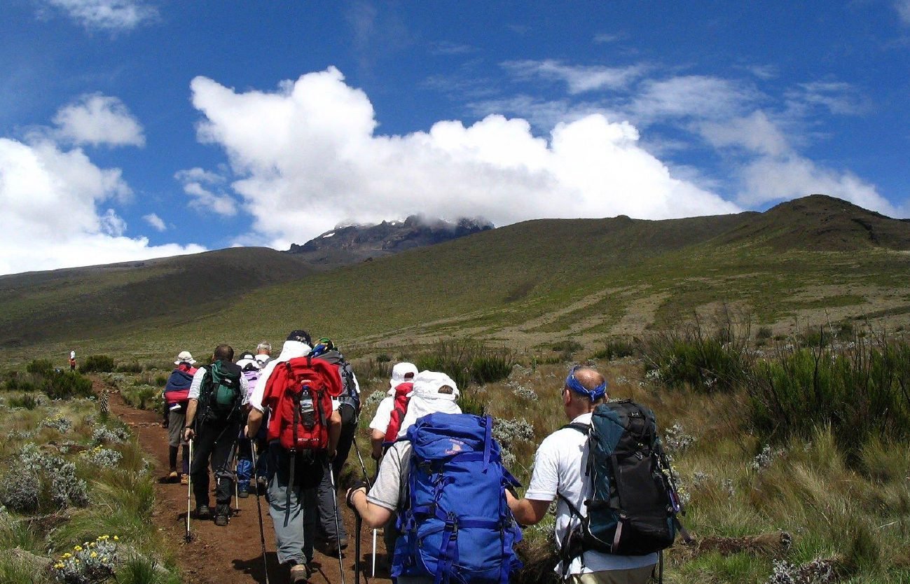
Routes for Hiking Mount Kilimanjaro
Mount Kilimanjaro hiking is easier in a way that the trekkers/hikers are able to access different hiking trails which are categorized in the ease of hiking. There are 6 routes that are fully approved for hiking the tallest mountain in Africa to be able to reach Uhuru Peak. The routes where hiking can be done include; the Lemosho Route which is a 70-kilometre trail that passes through the Londorossi Gate. This route is among the best routes for clients since it has registered high successes to the peak. Another route is the Umbwe Route which is regarded as among the hardest routes. Success in this route is hard because of the short acclimatization time. We also have the Shira Route which approaches the mountain from the west close to the Lemosho Route. This route is used by a few hikers since it was replaced by an easier route i.e. the Lemosho Route. The Rongai Route is also one of the Kilimanjaro hiking routes and is also among the hardest routes to hike since there is a short time for acclimatization. There is also the Marangu Route commonly known as the “Coca Cola” route and is the oldest route to use while hiking Mount Kilimanjaro. It is one of the cheap options for hiking and it also has a permanent dormitory of sleeping huts for the hikers. Finally, we have the Machame route which is the longest route to hike the mountain. It is long but considered a better option by hikers because it has better acclimatization time. It is also known as the “Whiskey Route“. With all these given routes, be sure to prepare yourself by doing some drills for hiking, and also remember to look out for some facts about hiking Mount Kilimanjaro.
Best Time to Visit Mount Kilimanjaro
Mount Kilimanjaro is located near the Equator and therefore, the areas around the mountain receive Dry Seasons and wet seasons. Hiking Mount Kilimanjaro is quite dangerous when the weather is messy for example during the wet seasons, it is dangerous because of the slippery trails, snow, mud and other weather disasters which might be of harm to the body. Therefore, this leaves the Dry season being the best time to hike Mount Kilimanjaro. The dry months which are favourable for hiking are the months of December to March and those of late June through to September. Therefore, be sure to book your Mount Kilimanjaro Hiking Safari during these months.
Wildlife Species in Mount Kilimanjaro National Park
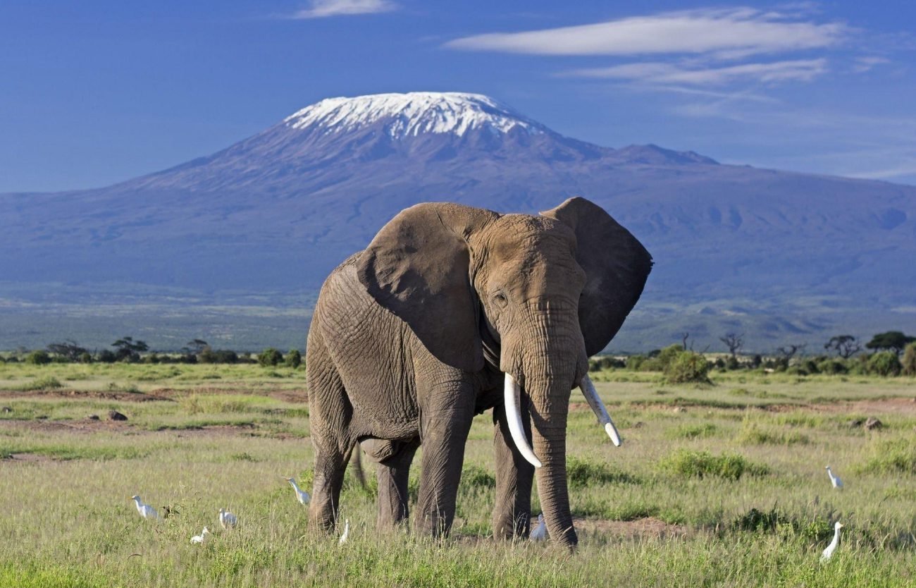
This being a national park, it harbours quite a number of wildlife species that may be eye-catching to the traveller who is on a safari across the Kilimanjaro Plains and may be planning to hike the great mountain. Some of the wildlife species include the cape Buffaloes which leave in the mountain forest that surrounds the National Park. Another of the most eye-catching species is the African Elephants which are seen in big herds traversing the lands between Namwai and Tarankia rivers. In the montane forest, you will be able to find primate species like the blue monkeys, western black and white colobuses, bush babies, and other species like leopards, giraffes, bats, and antelopes among others. It is quite an amazing experience for those who are planning to hike to be able to view different kinds of wildlife species as traverse Mount Kilimanjaro National Park.
Kilimanjaro’s Weather & Climate
The bush regions and rainforests surrounding Mt. Kilimanjaro have an annual temperature range of 70 to 80 degrees Fahrenheit (21 to 27 degrees Celsius). Because of the park’s proximity to the equator, the temperature rarely changes much during the year, so expect 70 to 80 degrees all year. The hottest months are from January to March. Ascending the mountain, though, the temperatures drastically shift. The temperature varies dramatically at the peak of the mountain. Its great height makes temperatures resemble those of an arctic environment. At such an altitude, temperatures can drop to -20 degrees Fahrenheit (-29 degrees Celsius) during the night. Because of this diversity, it is impossible to categorize the entire region as having a single climate.
November to December and March to May are the wettest months, with rainfall averaging 13.8 inches. June to October are the driest months, with rainfall as low as 0.6 inches. However, the amount of precipitation falls steadily over the course of the year. Because of the park’s characteristics and proximity to the equator, this is the case.
Throughout the year, the humidity remains relatively high, only dropping to 57 per cent on rare occasions but reaching 77 per cent on others. The spring and summer months have the most humidity, while the fall and winter months have the lowest. Due to the high humidity and precipitation, which causes moisture to stick to the air, there is a lot of fog in this area, especially in the rainforests. Between May and October, the area is primarily affected by northeastern trade winds, with southeastern trade winds having a minor impact between November and March. Maintaining a high level of precipitation in the spring and a lower level of precipitation in the summer, fall, and winter.
History of Kilimanjaro National Park
Kilimanjaro National Park has a long history in Tanzania, dating back to the colonial era. For Arab and Chinese traders, the mountain served as a marker. The mountain (described as a snow island in the sky) first appears in the writings of Ptolemy, a Graeco-Roman polymath (a man of many skills) who lived in the first century AD and was a historian, writer, astronomer, geographer, and mathematician. It was not mentioned by Chinese scholars until roughly seven centuries ago.
Johann Rebmann, a missionary, published a story in 1849 that was widely disbelieved. In 1885, the German Protectorate of Kilimanjaro was established. Hans Meyer, a German geographer, and Ludwig Purtscheller, an Austrian mountaineer, were the first to reach the summit of Kilimanjaro in 1889. It was referred to as “Germany’s highest peak” at the time. Kilimanjaro has since become a popular hiking destination for both locals and visitors. Mount Kilimanjaro and its surrounding woods were designated as a game reserve by the German colonial administration until it was assigned to the British as a Protectorate under the League of Nations until Tanzanian independence in 1961.
Kilimanjaro was established as a forest reserve in 1921, following the eruption of Mount Kilimanjaro. To safeguard its unique ecosystem, the mountain and its six adjacent forest corridors were declared a national park in 1973. In 1987, the park was designated as a UNESCO World Heritage site, and in 2005, it was expanded to include the entire tropical forest that had previously been part of the Kilimanjaro Forest Reserve, and where certain species found on an Mt. Kilimanjaro climbing field trip are found nowhere else on the planet. The indigenous Chagga people still farm the lower hills. The blue monkey is one of the many species that dwell in the area surrounding the mountain. Since then, the main attractions of Kilimanjaro National Park have been Mount Kilimanjaro, Africa’s highest mountain, as well as the park’s surrounding forests and rare wild species.
Since 1973, when Kilimanjaro was designated as a national park and a UNESCO World Heritage Site, the Tanzanian government, in collaboration with conservation international bodies, has been working hard to preserve and conserve the mountain and its surrounding forest in order to maintain its origin, reputation, and identity. Despite the effort of conservation of the mountain, According to National Geographic, researchers and other conservationists have been predicting and commenting that the glaciers of Mount Kilimanjaro may disappear as soon as 2030, and some more optimistic scientists project the extinction date for the Furtwangler Glacier to be 2060. However, both dates are well within the lifetimes of many readers.
Kilimanjaro means “mountain of whiteness” or “shining mountain,” according to most linguists and etymologists who investigate the origins of local words. The name is thought to be a blend of two words from distinct tribal languages (“Kilima” means mountain in Swahili and “Njaro” means shining/whiteness in Chagga).
Formation of Mount Kilimanjaro
Mount Kilimanjaro’s three summits were made millions of years ago by volcanic explosions. Shira, one of the volcanic cones, is now extinct and degraded, while Mawenzi and Kibo, the other two, “melted” together during successive eruptions. With its iconic Uhuru summit at about 6000 meters above sea level, Kibo is now the highest.
Mount Kilimanjaro is made up of three volcanic cones that originated as a result of extensive continental rifting. Volcanic activity is considered to have started some 1 million years ago when molten lava began to burst through fractures in the lithosphere caused by the thinning of the crust. This lava had a low viscosity at first and expanded outward to form a gently sloping foundation. Continued eruptions released heavier, more viscous lava, eventually forming the Shira volcanic cone. The Shira cone fell into a vast caldera (a cauldron-like cavity much bigger than the original volcano) after volcanic activity halted, forming the Shira Ridge. Following eruptions, Kilimanjaro’s two additional main volcanic cones, Mawenzi and the currently inactive Kibo, as well as smaller parasitic cones, were formed.